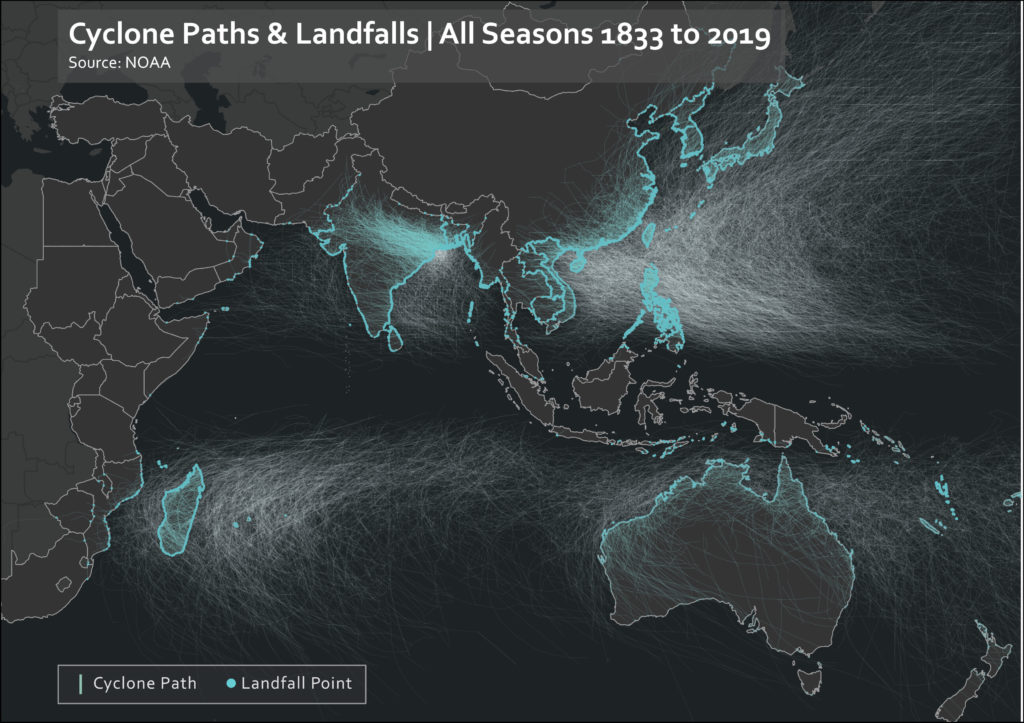
Taken from the NOAA International Best Tracks Dataset, this visualization shows the paths of all recorded hurricanes in the Indian Ocean World (in white), as well as their landfall points (blue dots) and overland paths (darker blue lines).

Taken from the NOAA International Best Tracks Dataset, this visualization shows the paths of all recorded hurricanes in the Indian Ocean World (in white), as well as their landfall points (blue dots) and overland paths (darker blue lines).
